What Types of Air Pollution Detection Drones Are Available?
Air pollution rarely forms a uniform cloud. Near a busy road, exhaust can rise and thin within minutes; around an industrial site, wind may carry emissions beyond the fence. Air Pollution Detection Drones help researchers examine these changing conditions from above, carrying compact sensors that measure particles or selected gases. Some systems also record temperature, humidity, location, and altitude, details that help interpret readings rather than treat each number as a complete answer.
The available types differ mainly in flight design and purpose. Multirotor drones can hover beside a plume or follow a short, carefully planned route. Fixed-wing models cover broader areas efficiently, but they cannot remain over one point. Hybrid vertical-takeoff aircraft combine some benefits of both. Tethered platforms can support longer observations, though their cables limit movement. Each option has trade-offs. Small details matter.
This guide compares these drone types, their common sensor payloads, and the situations they suit. It also considers practical limits, including battery life, wind, sensor response time, and calibration. A drone reading is not automatically a reliable exposure estimate; height and sampling method can change the result. Ground instruments and repeated measurements may provide useful checks. Still, no single flight tells the whole story. Choosing a platform means matching its capabilities to the question, not simply selecting the aircraft with the longest range or the most sensors. A little caution belongs in every measurement.
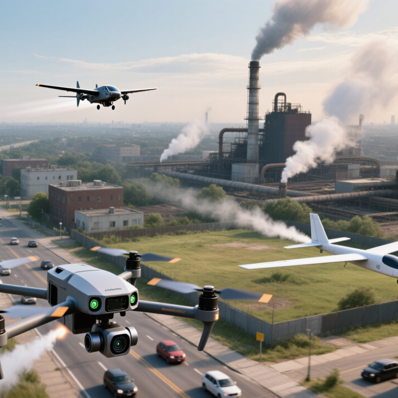
Air Pollution Detection Drones by Flight Platform
Multirotor drones can hover beside a road, factory boundary, or rooftop vent. Their steady position helps operators compare readings at specific heights and locations. They suit short surveys with compact gas or particle sensors. The trade-off is flight time: carrying heavier instruments can shorten each mission. Hovering also uses energy quickly. That matters.
Fixed-wing platforms cover larger areas in one flight. They move continuously along planned routes, making them useful for mapping pollution patterns across fields or industrial districts. Their sensors collect measurements as the aircraft travels, so results depend on route spacing, wind, and sampling speed. They cannot hover over a single emission point. Not always ideal.
Vertical take-off and landing platforms combine rotor-based take-off with forward flight. They can launch from a small open area, then survey farther than many multirotors. This can be practical where a runway is unavailable, though the transition between flight modes adds operational complexity. The platform is only part of the measurement system. Sensor calibration, weather, and flight speed affect data quality, and a drone reading may not represent ground-level exposure everywhere. In practice, comparing platforms is less tidy than a chart suggests. The best choice depends on the survey area, required detail, and payload weight.
Multirotor Drones for Localized Air Sampling
Multirotor drones are useful when air quality changes over a small area, such as around a construction site or near a road. Their ability to hover lets an operator collect samples at chosen heights instead of relying on a single ground-level reading. A compact sensor or sampling inlet can be carried beneath the aircraft. Keep the inlet clear of the propellers and the drone body.
Rotor wash matters. Downward airflow can disturb nearby particles and affect readings, especially during hovering. A careful sampling plan may use a steady position, consistent height, and recorded wind conditions. Short flights help limit battery and payload constraints. Small details count.
The drone’s readings need context. Operators should check sensor calibration, note temperature and humidity, and compare results with a suitable reference instrument when possible. A map of sampling points can reveal local differences, but it cannot explain every cause. I would be cautious about treating one flight as a firm conclusion; wind shifts, sensor response time, and placement can all complicate interpretation. Multirotors provide flexible access to localized air samples, while reliable findings still depend on disciplined measurement and clear reporting.
Fixed-Wing Drones for Wide-Area Monitoring
Fixed-wing drones can survey large areas of air pollution in a single flight. Their wings generate lift efficiently, helping them stay airborne longer than many multirotor aircraft. This can make them useful for mapping pollution across industrial edges, farmland, or a city’s outskirts.
Coverage matters.
A planned route can collect measurements at set intervals, creating a clearer picture of how concentrations change across distance.
The aircraft can carry instruments that measure gases or particles, but the results depend on sensor choice, placement, and calibration. A reading near an exhaust plume may differ sharply from one collected a few hundred metres away. Operators should record altitude, weather, and flight time alongside each sample. Ground-based readings can help check whether airborne measurements are representative.
Wind shifts and turbulence still complicate comparisons. Not perfect. A wide survey may miss brief pollution peaks, and sensor response times can blur sharp changes. Flight plans often need adjustment after reviewing early data; that part is easy to underestimate.
Fixed-wing monitoring works best when broad coverage is paired with careful sampling and transparent notes about uncertainty.
Hybrid VTOL Drones for Flexible Surveying
Hybrid VTOL drones combine vertical takeoff with forward flight, making them useful for air pollution surveys across varied terrain. They can lift from a small clearing, climb above rooftops, then cover longer routes without needing a runway. That flexibility helps teams sample near roads, industrial edges, or changing land use. A compact sensor payload may measure particulate matter or selected gases, while GPS and flight logs connect readings to location and time.
Good measurements still depend on careful setup. Sensors need suitable calibration, and temperature, humidity, vibration, and wind can affect readings. A drone passing a smokestack may record a brief plume, not the area’s usual air quality. Short. Survey plans should include repeat passes and, where practical, checks against trusted ground instruments. Operators should also record altitude and flight conditions, since a reading taken near the ground may differ from one taken higher up. Hybrid aircraft can save time over broad routes, but they are not a shortcut around sound sampling. I would not treat one flight as definitive; even a well-planned survey can miss shifting pollution between passes.
What Types of Air Pollution Detection Drones Are Available? — Hybrid VTOL Drones for Flexible Surveying
Multirotor drones can hover for localized sampling, fixed-wing drones can cover larger areas, and hybrid VTOL drones combine vertical takeoff and landing with efficient forward flight. Air-quality sensors can be selected for pollutants such as particulate matter and gases. The chart shows WHO 2021 PM2.5 guideline levels as reference values, not drone performance measurements.
Source: World Health Organization, Global Air Quality Guidelines (2021). Concentrations are in µg/m³.
Specialized Drones for Targeted Pollutant Detection
Specialized air-pollution drones carry sensors selected for a specific pollutant, not a universal “air quality” package. Electrochemical instruments can track gases such as nitrogen dioxide, sulfur dioxide, and carbon monoxide. Optical particle counters estimate particulate matter, while laser-based instruments can detect methane. A broad-response sensor may flag changing volatile organic compounds, but it usually cannot identify each compound on its own. That distinction matters.
The World Health Organization’s 2022 air quality database reported that 99% of the global population lived where air-quality guideline levels were not met, using 2019 data. WHO also estimated that ambient air pollution caused 4.2 million premature deaths that year. These figures underline why targeted measurements matter: a drone mapping a roadside nitrogen-dioxide plume needs a different payload from one checking fine particles near a dusty site.
Good readings need more than a sensor. Teams should match the instrument’s detection range and response time to the suspected source, then record flight height, wind, temperature, and humidity. A small drone can sample a plume at several heights. Useful, but not effortless. Sensor drift and rotor wash can distort readings, so calibration and comparison with a trusted reference station are essential. The EPA’s air-sensor guidance likewise cautions that non-regulatory sensors need careful interpretation; a colorful map alone is not proof.


